Satellites Help Solve the Climate Crisis: DW
Over the course of three decades, satellite images from space agencies like NASA and ESA demonstrate how Earth’s changing weather patterns affect land, water and communities. Satellites monitor the rising carbon dioxide levels, rising seas, flooding, global temperatures, tree loss and gains, and more. A mission under development known as the Environmental Mapping and Analysis Program, or EnMap, “uses a high-resolution hyperspectral sensor technology to monitor Earth's ecosystem,” reports Olivera Zivkovic for Deutsche Welle. The system allows for better images and can detect changes not visible to the human eye. Researchers suggest that the new satellites are sensitive enough to detect the effects of microplastics in waterways, gauge unusual water use, and predict nutrient deficiency or pest infestations in crops. The satellites provide an early warning system so that governments, companies and NGOs can respond. Governments fund the programs and scientists develop the tools, but political will to analyze and act on the data may be lacking – YaleGlobal
Satellites Help Solve the Climate Crisis: DW
As the world grapples with a climate emergency, scientists explore satellite technology solutions to assess damage and help combat climate change
Thursday, December 26, 2019
Read the article from Deutsche Welle about EnMap, an advanced satellite system that provides images of the Earth.
Explore the EnMap mission.
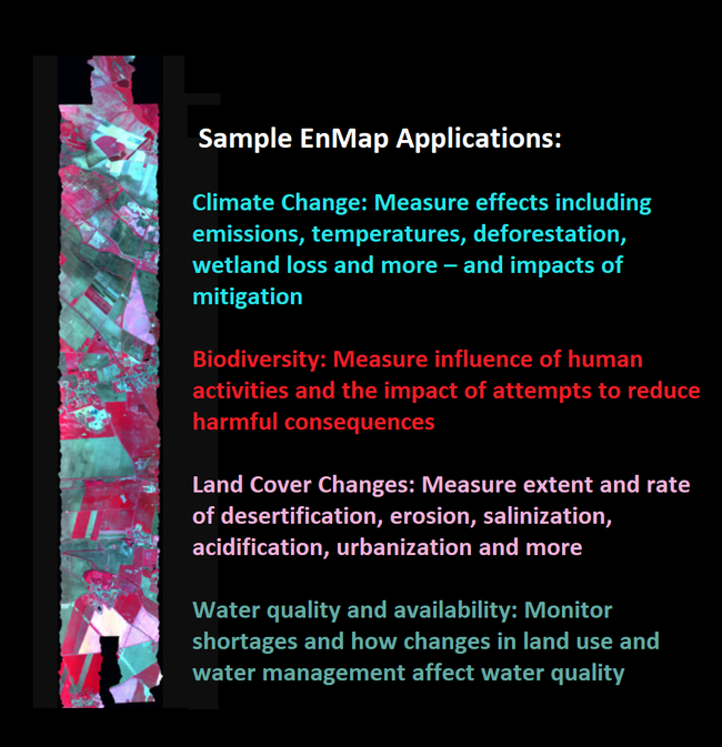
More data, more solutions: Satellites provide endless maps and data, offering many new applications, and data on the EnMap website are provided free of charge under a Creative Commons Attribution International License (Source: EnMap)
Deutsche Welle
© 2019 Deutsche Welle